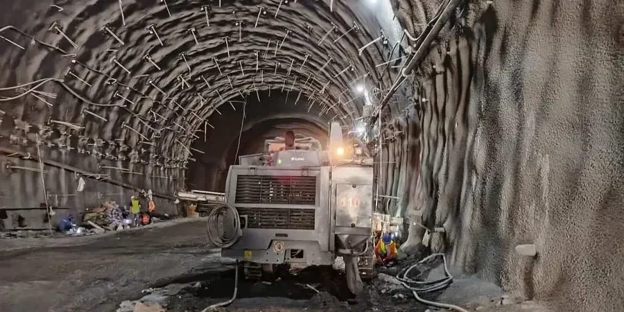
Knoxville’s subsurface rarely reads the textbook. Between the limestone pinnacles of the Ridge-and-Valley province and the deep residual soils weathered from the Chickamauga Group, every excavation tells a different story. We have seen competent rock give way to totally decomposed seams within the same bench, a transition that catches even seasoned earthwork contractors off guard. Our approach to geotechnical excavation monitoring starts with that expectation: conditions will shift, and the instrumentation plan must be responsive from day one. By pairing automated inclinometers with manual survey verification, we build a data stream that lets superintendents make decisions before minor drift becomes a safety incident. That local lens, shaped by hundreds of projects from the Fort Sanders neighborhood to the Hardin Valley expansion, keeps monitoring practical rather than academic. For deeper urban cuts near existing foundations, we often coordinate with CPT testing to refine the stratigraphic model without disrupting adjacent traffic, and incorporate retaining wall performance baselines when shoring systems are part of the permit package.
In Knoxville’s residual soils, a 2-millimeter movement trend over 24 hours is the difference between a routine adjustment and a stop-work order.
Local context
A 14-story mixed-use project on a Cumberland Avenue slope taught us that the biggest risk is not the excavation depth, it’s the legacy infrastructure nobody mapped. A 1920s brick sewer, undocumented and partially collapsed, ran within six feet of the shoring line. Our real-time tiltmeters caught an asymmetric rotation in the soldier pile wall that the survey crew’s biweekly readings had not yet flagged. Within two hours, the GC had backfilled the zone and the city’s utilities division was on site. Without continuous monitoring, that rotation would have propagated into a street closure and a six-figure emergency repair. That episode underscores a reality we see across Knoxville: urban excavations intersect century-old utilities, karst features, and variable fill that make probabilistic risk models unreliable. The instrumentation program is not a compliance checkbox; it is the only objective voice on a noisy site where gut instinct and production pressure collide. We still reference that project when training new field engineers on threshold interpretation, because the data never lied, even when the visual inspection looked acceptable.
Common questions
What does a geotechnical excavation monitoring program typically cost in Knoxville?
For a standard urban excavation in the Knoxville area, monitoring programs generally run between US$940 and US$2,770 per month, depending on the number of instruments, reporting frequency, and whether vibration monitoring is required. A basic array with two inclinometer casings, three piezometers, and weekly manual readings falls toward the lower end. Adding automated data acquisition, cellular telemetry, and daily engineer-reviewed reports moves the budget upward. Every quote includes a site-specific instrumentation plan so you see exactly what drives the cost.
How do you set movement thresholds for a site near historic buildings in downtown Knoxville?
Thresholds are set in two tiers: an alert level and an action level, both calibrated to the building’s structural system and foundation type. For unreinforced masonry structures common in the Old City and along Gay Street, we often adopt angular distortion limits tighter than the standard 1/500, referencing Burland and Wroth’s damage classification. The monitoring plan specifies who gets notified at each tier and within what timeframe, so the contractor never has to guess whether a reading is critical.
Is continuous monitoring required for all excavations, or can manual readings suffice?
It depends on the proximity to sensitive structures and the expected rate of movement. A shallow utility trench in open ground might only need weekly manual inclinometer readings. A 30-foot cut adjacent to an occupied hospital wing, however, justifies automated inclinometers and piezometers with a 15-minute sampling interval. We recommend the minimum viable instrumentation density to meet the project’s risk profile, and we explain that recommendation in plain language during the pre-construction meeting.
What happens if an instrument reading exceeds the threshold during active excavation?
The field technician immediately verifies the reading with a redundant measurement to rule out sensor drift. If confirmed, a stop-work notification is issued to the superintendent and the geotechnical engineer of record within 15 minutes. We then convene a rapid review call, share the trend data from the preceding 48 hours, and recommend whether the response should be increased support, revised sequencing, or localized backfill. The protocol is rehearsed during the kickoff meeting so there are no surprises when it counts.
How do you handle monitoring during blasting in Knoxville’s limestone formations?
Blast monitoring adds triaxial geophones and overpressure sensors to the standard array, positioned at the nearest structure and at intermediate distances to capture attenuation. We use DIN 4150-3 criteria for peak particle velocity and air overpressure, and we correlate blast logs with vibration records so the blaster can adjust charge weight per delay in near-real time. Post-blast reports are filed the same day and include both compliance data and a plain-language summary for non-technical stakeholders.