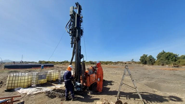
When we mobilize an excavator or backhoe to a site in Knoxville, the first thing we check is the access path relative to the slope grade—because half the lots in this city sit on some variation of the Chickamauga limestone formation, and you learn quickly that what looks flat from the street often hides a 15-degree dip 40 feet back. An exploratory test pit lets us step into the excavation, trim the wall with a shovel, and log the actual stratigraphy face to face. No split spoon, no cone rods—just direct observation of how the red residual clay transitions into weathered rock or hits a pocket of terra rossa at four feet. In downtown redevelopments near the Tennessee River, we often combine the pit with an SPT drilling program to correlate refusal depths, and for pavement design in commercial pads off Kingston Pike, we bring in in-situ density testing once the fill is placed. At this latitude (35.96°N), the freeze-thaw cycle only penetrates the upper 12 to 18 inches, so the pit walls stay stable long enough for a thorough documentation session.
A well-executed test pit in Knoxville’s karst terrain reveals more about bearing conditions in 20 minutes than three days of indirect geophysics, provided you log the walls before they dry out.
Process overview
Knox County sits almost entirely over Ordovician carbonate bedrock, which means the weathering profile is wildly inconsistent—one test pit can show six feet of stiff fat clay, and the one thirty yards away can hit pinnacled rock at two feet. Our field team maps the pit faces using the Unified Soil Classification System per ASTM D2487, recording moisture content, consistency, and the presence of manganese staining or chert fragments that signal proximity to the bedrock interface. We photograph each wall under natural light and collect bag samples for
Atterberg limits and
grain-size analysis back at the lab, because the fines content in Knoxville’s residual soils often exceeds 60%, and plasticity indices above 25 are common in the Conasauga shale-derived clays found north of the river. Depth to groundwater is another critical observation; in the Bearden area and parts of West Knoxville, we have encountered perched water tables at less than seven feet during the wet season, which changes the excavation support requirements immediately. Every pit log includes a sketch of the stratigraphic column, the GPS coordinates tied to the Tennessee State Plane Coordinate System, and a note on the time elapsed between excavation and logging—because slaking of shale fragments can alter the appearance of the cut face within hours under direct sun.
Local context
Knoxville’s urban expansion since the 1982 World’s Fair has pushed development onto land that was historically bypassed—steep hillsides in South Knoxville, infill lots in Mechanicsville, and re-graded pads in the Turkey Creek watershed. Each of these settings carries a distinct set of geotechnical hazards that a test pit can expose early. Old undocumented fills are the most common surprise: we have pulled bricks, cinders, and even sections of cast-iron pipe from pits that were supposed to be in “undisturbed” soil. A pit that reveals organic silt or buried topsoil at foundation grade signals potential differential settlement that no amount of compaction can fix without removal. In karst zones, the pit may bottom out on a solution cavity or show evidence of soil piping along a jointed limestone surface, which demands a deeper investigation—often following up with CPT soundings to map the extent of the anomaly. The direct observation from an exploratory test pit converts these hidden problems into documented facts, allowing the design team to adjust the foundation type or drainage plan before concrete is poured.
Common questions
What is the typical cost range for an exploratory test pit in Knoxville?
In the Knoxville metro area, a single exploratory test pit generally ranges from US$450 to US$830, depending on access conditions, required depth, and whether laboratory testing of samples is included. Sites with difficult access or the need for benching beyond 5 feet in depth tend toward the upper end of that range.
How deep can you go with a test pit in East Tennessee’s residual soils?
Practical depth is usually limited to 12 to 15 feet with a standard backhoe, though in Knoxville’s stiff red clays we can often maintain near-vertical walls to 10 feet without excessive sloughing. The real limit is often bedrock refusal rather than machine reach; the Chickamauga limestone frequently appears at 4 to 8 feet below grade, at which point we log the rock and stop the excavation.
What do you look for when logging a test pit wall?
We document soil type changes, consistency, moisture, color mottling, and any structural features such as slickensides or fissures. In Knoxville’s karst terrain, we pay particular attention to the transition zone between residual clay and weathered bedrock, looking for clay-filled solution features, manganese staining, and zones of softened rock that could affect bearing capacity calculations.
Are permits required for test pit excavation in Knox County?
Permit requirements depend on the site location and scope. Within Knoxville city limits, excavation work must comply with Tennessee One-Call (811) utility location procedures, and any pit left open overnight may require fencing or plating per local safety codes. For commercial projects, the geotechnical report including test pit logs is submitted as part of the building permit package under IBC Chapter 18.